- 課程代碼
- 5115
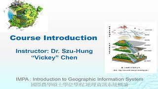
- 課程名稱
- 地理資訊系統概論
- 學分
- 3
- 學期
- 1122
- 修課人數
- 22 人
- 老師
-
 陳思宏 Szu-Hung Chen國際農學 (G30G)
 - 課程簡介
This course will focus on introducing students to how they can apply geographic information system technology to analyze target issues, such as problems related to natural resource management.
Topics covered include an introduction to operating GIS software (e.g., QGIS), identifying and understanding “big data” or “cloud datasets” with spatial information, the formulation of the analyzing framework, GIS applications for problem-solving, as well as other toolkits such as Google Earth, Google Map, or MS Excel (data preparation, processing & management), which may be introduced and used to aim the analysis.
Parts of this course will require hands-on practice using computers. Thus, students are expected to bring Their Laptops to the classroom when needed. Also, the operating software will Function Better under Window Operating System. Using a laptop with Window Operating System is highly Recommended.
- 課程大綱
- [Course Objectives]
For general outcomes, students are expected to learn:
- Identify data needs relating to target issues and appropriate processes in the context of a GIS project.
- Formulate or assess a framework in spatial perspectives, then understand their applicability for problem-solving.
- Design maps based on cartographic principles as a form of visual communication.
- Develop a reasonable executing plan and timelines that can lead to a desired project outcome.
- Represent the recognition regarding the responsibility of adhering to ethical standards in decision‐making for clients and the public.
- Interpret the analyzing findings and deliver a technical report outlining problems and suggesting potential solutions.
For specific outcomes, students are expected to :
- Deliver and present a final project in a context of GIS and/or spatial analysis as professional practicum.
[Course Delivery]- This is an online, distant-learning and face-to-face hybrid course.
- All class materials can be accessed through NCHU iLearning 3.0. NCHU iLearning 3.0 will also be used to conduct class assessments (e.g., mid-term exam), to submit course assignments, to facilitate discussions, and to distribute announcements.
- NCHU iLearning can be accessed via NCHU iLearning 3.0 Portal (https://lms2020.nchu.edu.tw/ ) or NCHU Single Sign On System.
- Teaching methods include:
- Previewing and reviewing course materials.
- Hand-on practicing on modules and completing relating assessments.
- Developing a final project in a context of GIS applications and/or spatial analysis.
- Bonus assignments or random quiz may be given when needed.
- Office hours are running by the appointment-preferred policy.
- 教科書
- Class handouts and a list of assigned readings provided by the instructor through NCHU iLearning 3.0
- 成績說明
- Mid-Term Exam:20%;
- Assignment/Module Practices: 40%;
- In-class Performance(e.g., in-class discussions, quiz and other related activities):10%,
- Final Project Development: 30%, including Final Project Report (Individual)-- 10% and Final Project Presentation--20%.
- QR Code
- 放大